I haven't been blogging nearly as much as I want to. There are a few reasons for that.
I have what can be best described as a new project. It has been consuming a lot of my time. It is really my first "official" pursuit to explore my entrepreneurial desires.
I had this idea to make a sail shaped sign to display our address on our mailbox post. I went around and around with the design and struggled with many different material solutions.
Then I came across this plastic material that is made specifically for outdoor signs. This stuff is pretty cool. It has layers to it so that when you route out the top surface the center color shows through.
Anyways, since I needed to buy a full sheet of material to start I decided to make a go at getting into some craft shows etc. They haven't been too successful. So off to Etsy I went.
Take a look at my Etsy shop and let me know what you think.
Pruitt's Place
I am planning to make custom signs for pretty much any purpose. If you have an idea of something you would like to see. Let me know.
Thursday, December 9, 2010
Sunday, September 12, 2010
Miner Lake (Allegan County)
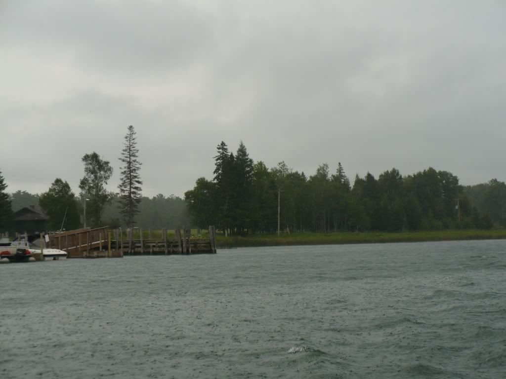
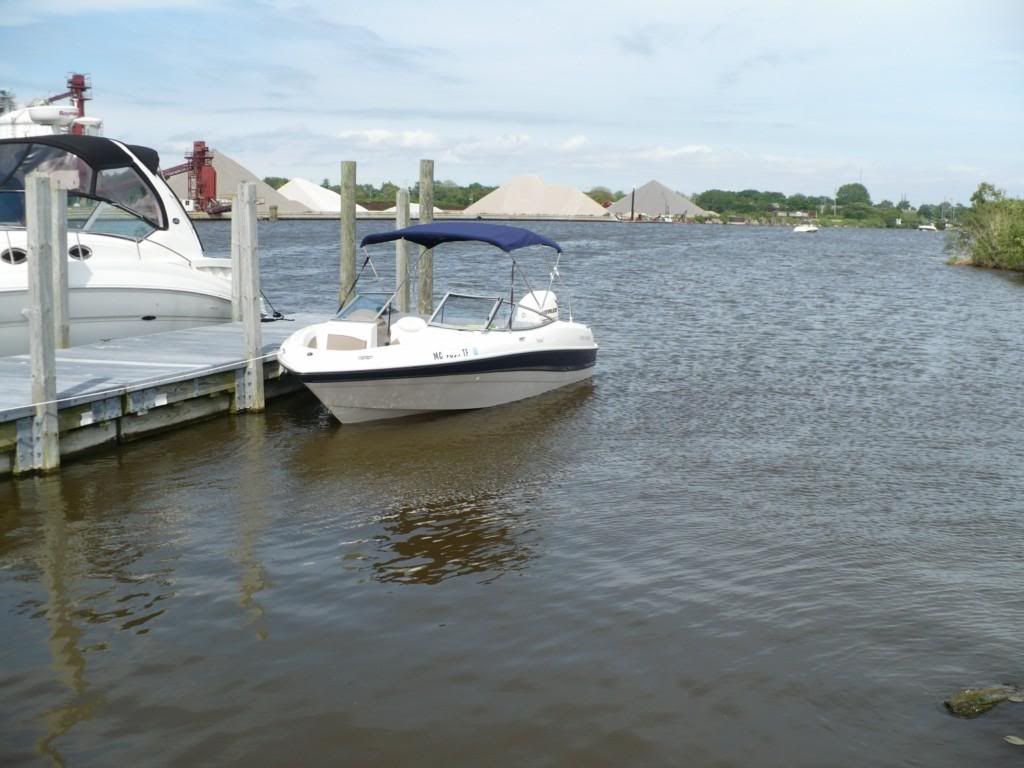
We went out to Miner Lake today. This lake is located in the middle of Allegan County just north of the town of Allegan.
This is a nice lake with many beautiful homes. There is a public launch ramp on the south west corner of the lake. The ramp is a concrete, one lane ramp in decent condition. The parking area is pretty small and only gravel. There is a pit toilet on site. This ramp is operated by the state of Michigan. I did not see any pay station or fees mentioned, however, I would guess there is a permit fee required.
The lake itself has a South bay that is quite large and is mostly very deep. There are, however, several sand bars that can be 1' or less in depth in areas quite far from land. On the East end of the lake there is a narrow area that connects the South bay to the North bay.
The North bay is smaller, yet still plenty big for watersports, etc.
In general this is a very nice lake.
Saturday, June 26, 2010
Les Cheneaux Islands (Mackinac County)
Day 2:
We had all day Saturday to spend on the boat and we were hoping for good weather. The morning was a little gloomy, however, the radar showed that any additional rain was a day away.
We went back the Hessel boat ramp since it is a good jumping off point for a day in the Islands.
What a wonderful day. We covered approximately 70 miles.
It went something like this:
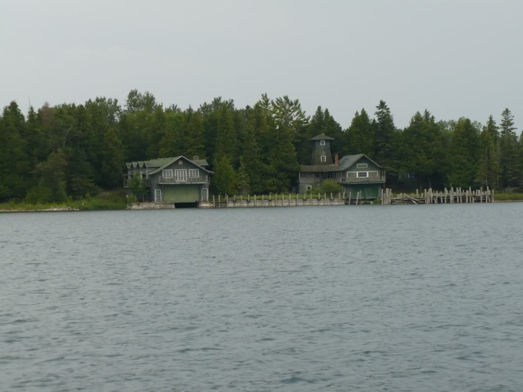
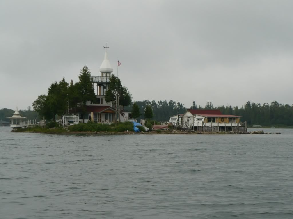
We again headed south out of Hessel to check the conitions on the open lake. It was better than yesterday, however, still not as smooth as I would like to make the large loop around Marquette Island. We again decided to head towards Cedarville through the Les Cheneaux Channel past Dollar Island again. We continued on through Muscallong Bay and into the channel that heads towards Cedarville. The are many very interesting homes and boat houses along these waterways.
Leg One TRACK
MORE LATER
We had all day Saturday to spend on the boat and we were hoping for good weather. The morning was a little gloomy, however, the radar showed that any additional rain was a day away.
We went back the Hessel boat ramp since it is a good jumping off point for a day in the Islands.
What a wonderful day. We covered approximately 70 miles.
It went something like this:
We again headed south out of Hessel to check the conitions on the open lake. It was better than yesterday, however, still not as smooth as I would like to make the large loop around Marquette Island. We again decided to head towards Cedarville through the Les Cheneaux Channel past Dollar Island again. We continued on through Muscallong Bay and into the channel that heads towards Cedarville. The are many very interesting homes and boat houses along these waterways.
Leg One TRACK
MORE LATER
Friday, June 25, 2010
Les Cheneaux Islands (Mackinac County)
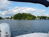
I had been wanting to get back to the Les Cheneaux Islands for a long time. The last time I was there my then girlfriend (now wife) were there with my family for the annual wooden boat show. This event draws some of the most exquisite examples of fine wooden boats in the world. The Les Cheneaux Islands and the communities of Hessel and Cedarville have always been popular for boating, fishing and just living in and on the water. It is a fantastic place to visit.
The last time we were in the Islands we had a bit of an adventure. For whatever reason we decided to take a 12' Zodiac with a 15 HP Mercury over to Mackinaw City from Cedarville. Yup, right across the Straits of Mackinac. Insane or not, this is a memory that has sort of shaped our future. I guess the islands and the general area have always been sort of a special place for us.
To celebrate our 10th anniversary we made sort of spur of the moment plans to go up to the islands. I found a nice little cabin that had reasonable nightly rates. There are many small resorts that offer cabins, camping and boat docks in the Cedarville and Hessel areas.
We headed up on a Thursday afternoon and planned to be on the water all day Friday and Saturday.
Day 1:
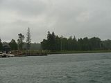
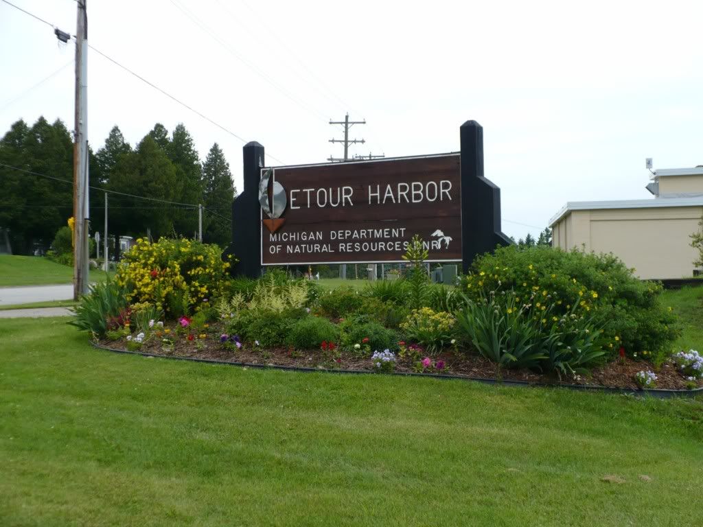
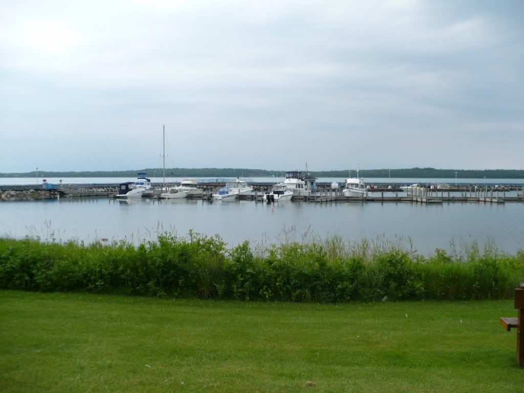
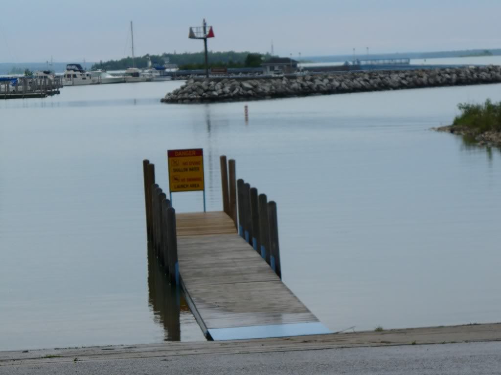
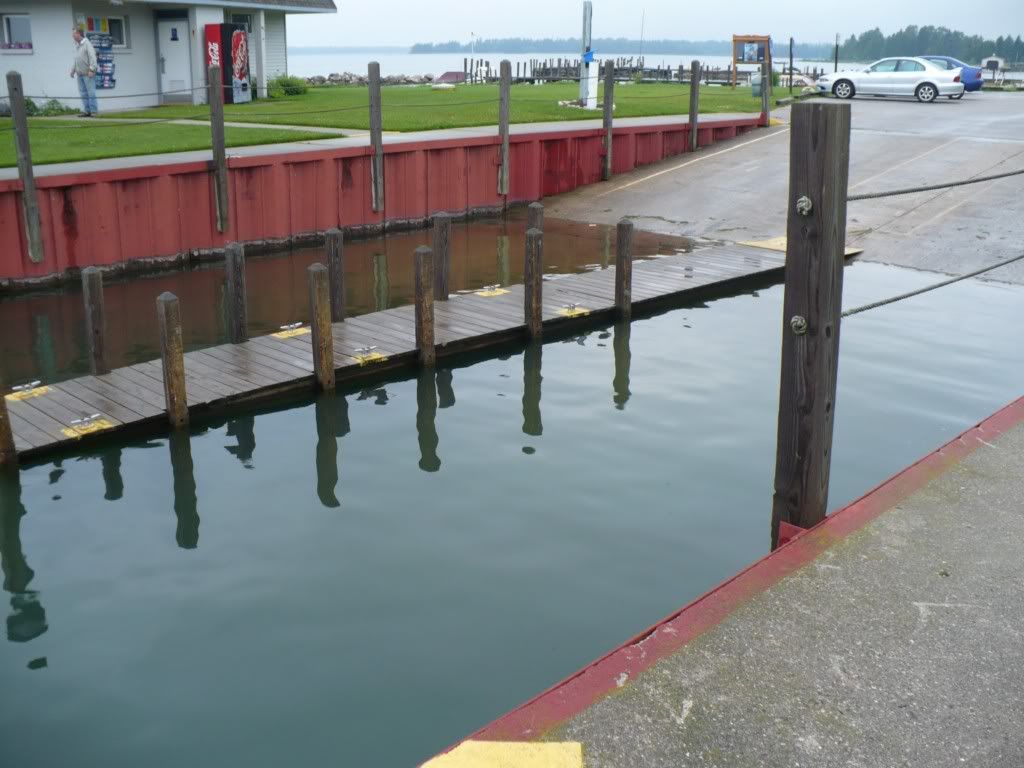
We had been watching the weather very closely leading up to Thursday when we left from home. As is so typical of Michigan in June the forecast was very inconsistent and not really looking too great. Knowing it was iffy I had sort of made plans to take a drive and check out a few of the other locations in the area. We used the wonderful radar that is available from wunderground.com for the iPhone to watch the various batches of rain that were passing through the area. We drove over to Detour Village in the morning just to do some sight seeing. I checking out a couple of the boat ramps in the area for future reference. There is a very nice state harbor in Detour Village and also a very nice boat ramp.


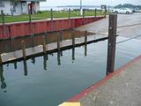
After lunch back at the cabin we saw what looked to be a few hour window that looked like it was going to be dry. We hitched up the boat and headed over to the Hessel marina. There is a very nice boat ramp right in Hessel that is operated by Clark Township. There is a $5 ramp fee and only limited parking right on site. The ramp has 2 lanes separated by a dock. The ramp is relatively steep, however, it has good grippy concrete.
To navigate in the waters surrounding the Les Cheneaux Islands takes some care. There are many places where the water is very shallow. Some of the areas are out in the middle of relatively open water. Most of the problem areas are marked and the main channels are marked appropriately with navigational buoys. There are huge boulders that peak through the surface of the water in many locations. I would highly recommend that you have a chart plotter with the appropriate charts loaded before you head out on these waters. Water levels have been lower over the last several years than has been normal in the past. Up to date charts can be a prop/lower unit/life saver.
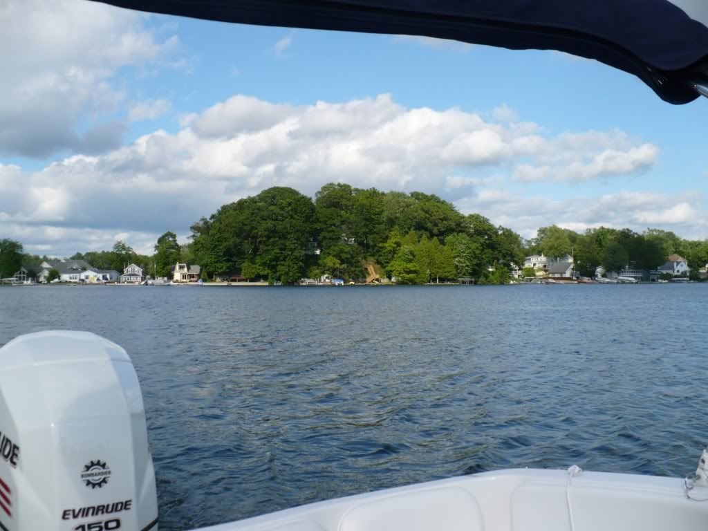
We were on the water by 3:20 pm. We headed out of Hessel bay towards the south to see how the conditions out on the open water looked. With the breeze and slight mist in the air the lake was not too inviting. We snapped a few pictures and then headed towards Cedarville through the islands. We made it half way through the Les Cheneaux Channel and it started to rain.
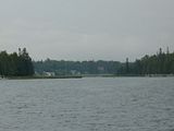
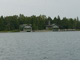
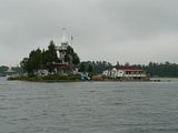
Many of the islands have large homes on them. Only one of the islands (Government Island) is publicly owned. In general there are not many areas where you can go ashore without potentially trespassing on private property. There are hundreds of boathouses and elaborate docks in the area.
We quickly snapped some pictures of Dollar Island and then started heading back towards Hessel. On account of the rain we had to take is slow all the way back. The boat got drenched and it made me wish I had pulled the carpet out like I had thought of doing before we left.
Here is the track of what we were able to do on day 1. This track was created using the Navionics app for the iPhone. This little app is pretty amazing. I used it as my sole chartplotter/navigation device. After a few checks for consistency to reality and testing I have found it is much more useful than some of the lower end chartplotters on the market. I can't say that this is the best and only device you should have though. One big concern is that the iPhone is anything but waterproof. I have an Otterbox Defender case which will keep a few stray drops of water from getting on the phone, however, it won't do much to protect it in a heavy downpour. You'll note the track was stopped well before we were back to Hessel. I decided to put the phone away to keep it protected.
We pulled the boat out in the rain and I did what I could to keep it dry the rest of the night...I couldn't do much as the boat was already pretty well soaked. The bimini top kept us and our stuff mostly dry which was good. I am seriously considering a full enclosure now though.
We had considered leaving the boat in the water. The cabins where we were staying had pretty nice docks right along one of the main channels. If not for the weather it would have been handy to have the boat already in the water for day 2.
The last time we were in the Islands we had a bit of an adventure. For whatever reason we decided to take a 12' Zodiac with a 15 HP Mercury over to Mackinaw City from Cedarville. Yup, right across the Straits of Mackinac. Insane or not, this is a memory that has sort of shaped our future. I guess the islands and the general area have always been sort of a special place for us.
To celebrate our 10th anniversary we made sort of spur of the moment plans to go up to the islands. I found a nice little cabin that had reasonable nightly rates. There are many small resorts that offer cabins, camping and boat docks in the Cedarville and Hessel areas.
We headed up on a Thursday afternoon and planned to be on the water all day Friday and Saturday.
Day 1:
We had been watching the weather very closely leading up to Thursday when we left from home. As is so typical of Michigan in June the forecast was very inconsistent and not really looking too great. Knowing it was iffy I had sort of made plans to take a drive and check out a few of the other locations in the area. We used the wonderful radar that is available from wunderground.com for the iPhone to watch the various batches of rain that were passing through the area. We drove over to Detour Village in the morning just to do some sight seeing. I checking out a couple of the boat ramps in the area for future reference. There is a very nice state harbor in Detour Village and also a very nice boat ramp.
After lunch back at the cabin we saw what looked to be a few hour window that looked like it was going to be dry. We hitched up the boat and headed over to the Hessel marina. There is a very nice boat ramp right in Hessel that is operated by Clark Township. There is a $5 ramp fee and only limited parking right on site. The ramp has 2 lanes separated by a dock. The ramp is relatively steep, however, it has good grippy concrete.
To navigate in the waters surrounding the Les Cheneaux Islands takes some care. There are many places where the water is very shallow. Some of the areas are out in the middle of relatively open water. Most of the problem areas are marked and the main channels are marked appropriately with navigational buoys. There are huge boulders that peak through the surface of the water in many locations. I would highly recommend that you have a chart plotter with the appropriate charts loaded before you head out on these waters. Water levels have been lower over the last several years than has been normal in the past. Up to date charts can be a prop/lower unit/life saver.
We were on the water by 3:20 pm. We headed out of Hessel bay towards the south to see how the conditions out on the open water looked. With the breeze and slight mist in the air the lake was not too inviting. We snapped a few pictures and then headed towards Cedarville through the islands. We made it half way through the Les Cheneaux Channel and it started to rain.
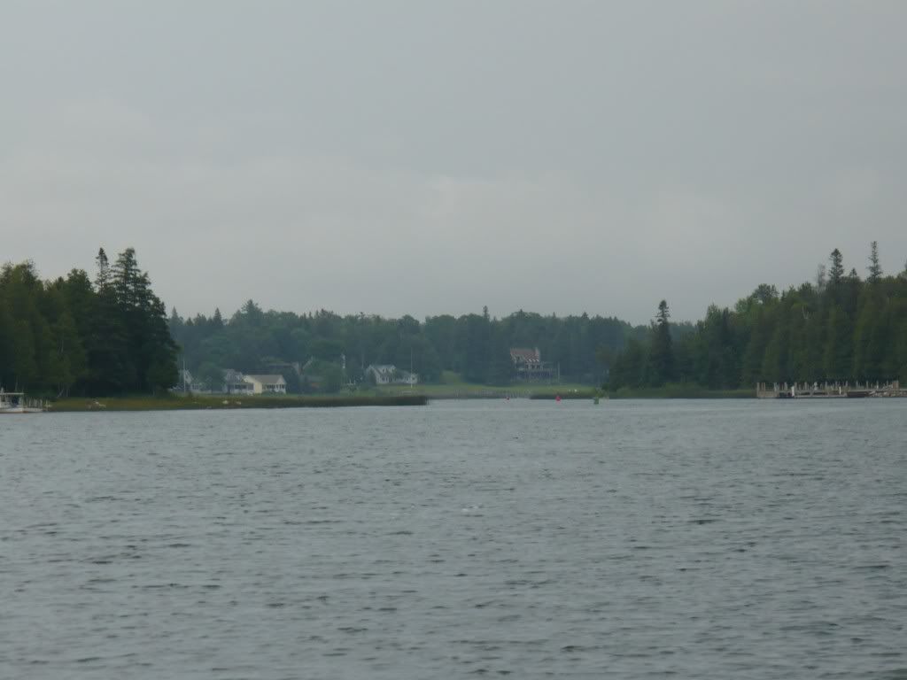
Many of the islands have large homes on them. Only one of the islands (Government Island) is publicly owned. In general there are not many areas where you can go ashore without potentially trespassing on private property. There are hundreds of boathouses and elaborate docks in the area.
We quickly snapped some pictures of Dollar Island and then started heading back towards Hessel. On account of the rain we had to take is slow all the way back. The boat got drenched and it made me wish I had pulled the carpet out like I had thought of doing before we left.
Here is the track of what we were able to do on day 1. This track was created using the Navionics app for the iPhone. This little app is pretty amazing. I used it as my sole chartplotter/navigation device. After a few checks for consistency to reality and testing I have found it is much more useful than some of the lower end chartplotters on the market. I can't say that this is the best and only device you should have though. One big concern is that the iPhone is anything but waterproof. I have an Otterbox Defender case which will keep a few stray drops of water from getting on the phone, however, it won't do much to protect it in a heavy downpour. You'll note the track was stopped well before we were back to Hessel. I decided to put the phone away to keep it protected.
We pulled the boat out in the rain and I did what I could to keep it dry the rest of the night...I couldn't do much as the boat was already pretty well soaked. The bimini top kept us and our stuff mostly dry which was good. I am seriously considering a full enclosure now though.
We had considered leaving the boat in the water. The cabins where we were staying had pretty nice docks right along one of the main channels. If not for the weather it would have been handy to have the boat already in the water for day 2.
Saturday, June 12, 2010
Spring Lake (Ottawa County)
When we took a trip on the Grand River we took a little side jaunt up Spring Lake. The lake is mostly within Ottawa County, however the very Northern end is located in Muskegon County.
Spring Lake is a essentially a branch off the Grand River just East of the city of
Grand Haven. There is also a town named Spring Lake that is positioned between the Grand River and the lake.
There is a fixed bridge at the entrance of the lake, vertical clearance is around 35ft. which should be adequate for just about any power boat. The lake is designated as slow no wake for boats over 26ft. Although, I think this rule is bent often.
The lake is about 5 miles long and is relatively narrow. The lake gets very busy and the wakes can cause the lake to be very rough. Watch out for the other guys, they likely aren't watching out for you.
Many of the homes on the lake look like they could be featured on an HGTV show about exquisite homes. The lake has a sort of high dollar feel.
There is one cove that is named "party cove" and as you can imagine this is a typical place that people congregate to party.
There are a couple of public ramps on the lake or you can easily get onto the lake from the Grand River or Grand Haven area. There is a gas dock located just beyond the bridge at the entrance to the lake from the Grand River.
Google Maps: Spring Lake
Grand River (Ottawa County)
We finally made a point to get on the Grand River a ways inland from Grand Haven. This is something I have never done and was always very curious to see this part of the world.
We put in at Riverside County Park which is about 15 miles (by boat) up river from the end of the break water on Lake Michigan. This is a very nice park with a 4 lane ramp and two docks. There is a $5 ramp fee which is very reasonable in my opinion. There is ample parking and a few nice picnic areas. There are pit toilets also. When we arrived there were many, many bass boat trailers in the lot since there was a tournament going on.
This park is located just West of a the end of a dredged/navigable channel on the river. When we were there the water was up enough that there was only a few locations where it was important to stay in the marked channel. In general depths ranged from 5-10 ft the whole length of the river until you get to Spring Lake. Once you are to that point the water is typically over 20 ft deep.
The river was up from recent rain and the current was running about 3-5 mph. I don't have a lot of experience with currents like this so it took me a little by surprise. I first realised it when we pulled up to the ramp and saw a log floating down the river. I had a little trouble getting the boat off the trailer, I guess the current was pushing it enough sideways that it took a little effort to get it free from the trailer. Make sure you use adequate dock lines at the bow and stern and secure them fastly to the the dock. The stern almost got away from us since I used only a 1/4" line. It stretched a lot when I had to pull it back to the dock.
The cruise down the river was leisurely and we enjoyed a picnic lunch on the boat. Long stretches of the river allow for running at speed. This map shows the areas that are slow no wake as the light blue areas with an orange outline. However, the location shown for the ramp at riverside park is not accurate. Typically the areas that are slow no wake are near the marinas or ramps and also along a relatively narrow stretch that has several homes and docks.
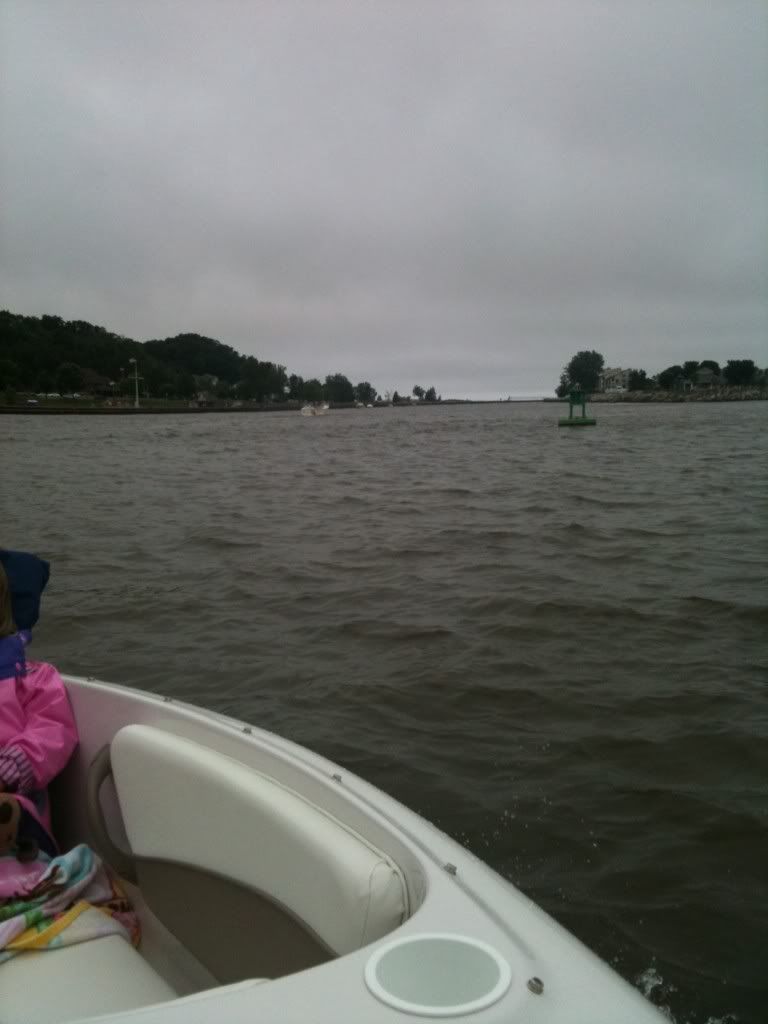
Once you are out to Grand Haven there are plenty of things to do and see. There is Lake Michigan (of course) and as long as the weather is calm a quick trip out to the lake is worth it. When were there the waves coming into the channel were 3-6' rollers and you could see that the lake was kicked up pretty good. We went out just past the old Coast Guard station on the North side of the channel. We snapped a couple of pictures of the pier and lighthouse from a distance and turned back.
For those not familiar with Grand Haven, It is the quintessential West Michigan shoreline town. There are a lot of things going on pretty much all year long. The town is considered "Coast Guard City" and hosts a very impressive festival every year. The beach is typical of many West Michigan beaches...the sand is clean and soft and you can walk for miles along the shore. The South pier and the "board" walk on the South side of the channel makes for a great walk and people watching adventure. There are plenty of nice streets in the downtown area with shops and stuff. Restaurants abound and there is pretty much anything for anyone. You can tie up along the sea wall near down town for a quick stop in town. For a longer stay, the municipal marina right in town offers transient docking. The city also operates a very large boat ramp that is just a little up the river from downtown. The launch fee is $10.
We spent some time beached along the North shore of the river right across from downtown. There is a nice sandy beach along this stretch of the river. This is a great place to let the kids play in the sand and water. The beach is just below the world famous musical fountain. For some, this may be worth the cost of admission alone. It is really quite an interesting experience...hard to put into words actually.

At the municipal boat ramp/park there is a nice dock that is available for a quick run to the public restrooms on shore. Don't plan to spend the day or more than a few minutes tied up. The dock can be a pretty busy place and is meant to be shared by everyone.
On the way back up the river we took a side jaunt up through Spring Lake before a quick run back to Riverside Park.
It was getting late in the day so we made good time on the way back to the ramp. We ran WOT for a couple of miles and averaged over 20mph including the no wake zones. As we were nearing the park we almost hit a large log that was floating just below the surface. Luckily we were in the a wake area so I had plenty of time to react....it did make me think again about all that time we were running well over 40 mph...what if????
Getting back to the dock on the ramp proved to be a bit of the challenge. There were several other boats sort of circling and it was obvious people were struggling. Remember that current I mentioned? Yeah, it made getting to the dock without really risking damage pretty tricky to say the least. I made one attempt to approach the dock on the down current side...bad idea. Almost lost the wife as she jumped to the dock and crashed and then almost crashed sideways into the boat at the other dock. The second attempt to the up current side of the dock was also a bit troublesome. Judicious use of the throttle in reverse saved us from too much damage. The third attempt wasn't pretty, but it worked. I guess I need to work on maneuvering in currents. Although, it was obvious this current was quite a bit stronger than anyone was really prepared for.
It was good trip and even though the weather was actually a bit chilly, we enjoyed it thoroughly.
Sunday, June 6, 2010
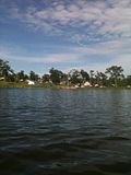
Green Lake (Allegan County)
This afternoon/evening we went over to Green Lake for a couple of hours. The weather was iffy all day until about 4pm. So we decided to go someplace close for a little "dinner" cruise. Even though dinner was only PB&Js, it was still nice.
I had only been on Green Lake one other time many years ago on a borrowed waverunner. At that time I didn't really bother to look around a see what a nice little lake it actually is.
A little over 10 years ago we almost bought a tiny little house up on a hill overlooking the lake. The house had deeded access to the lake and it was only $75k. Long story short, the house would have been too much work and there was no garage and very little room to build one. However, there is a little part of me that still thinks it would have been fun.
Green Lake is a small lake in Allegan County. It covers a little over 300 acres. It is a popular water skiing lake and fishing is quite popular also. There are sort of two sections of the lake separated by a relatively shallow narrows. The lake in general is very deep with abrupt drop offs. When you are out from shore 100' it is common to be in 30'+ of water. However, there are a couple of sandbars in areas that can take you by surprise. It is a good idea to have a depth finder so you can at least be aware of where a few of the shallow areas are.
It was pretty cool this evening and the lake was pretty quite. I assume that on hotter days a few of the sand bar areas are popular places to hang out and just be in the water. There is not public beach on the lake. Our kids were a little disappointed that they couldn't play in the sand.
There is a very nice public boat ramp on the lake. It is operated by the DNR. The ramp, dock and parking are all basically brand new. The ramp is a single lane concrete ramp with a single dock along the Port side. There is plenty of parking, however, on a warm summer weekend I'm sure it fills up quickly. I didn't see any signs regarding a fee to use the ramp. However, there was a small shed on site that could be used as a collection station on busy weekends. Since it is a state owned and operated facility, I would guess a State Park pass ($6 daily, $24 annual) would be required.
The Northern shore of the lake is mostly undeveloped and it would appear to be a good place to find some fish. Most of the rest of the lake is lined with cottages and year round homes. There are some new homes and a few vacant building sites at the end of the Northern bay.
All in all it is a nice little lake to visit if you are in the area. If you are looking to fish or ski and only need a couple of hours on the water it may work great for you. There is a slalom course set up on the main bay and it seemed that just about every boat on a lift in front of a house was a MasterCraft.
I don't know that there is much of a reason for us to go back any time soon. However, as it turns out, it is probably the closest boatable body of water to our home.
Google Maps: Green Lake
Subscribe to:
Posts (Atom)
